The Chokepoint That Carries the World: Tan Mu's Signal: Submarine Network 03 and the Strait That Connects Everything
The Strait of Hormuz is twenty-one nautical miles wide at its narrowest point. Through it passes roughly one fifth of the world's daily oil supply. Through it also pass dozens of fiber-optic cables carrying data between South Asia, the Middle East, and Europe. Two kinds of flow, one substrate. The same seafloor that holds the pipelines and tanker routes also holds the optical fiber along which a video call from Dubai to Mumbai travels in under thirty milliseconds. These two systems, built decades apart, serving entirely different orders of human need, share a single geological throat. If the strait closes, the oil market convulses and the internet slows to a crawl across three continents simultaneously. The vulnerability is not sequential. It is concurrent.
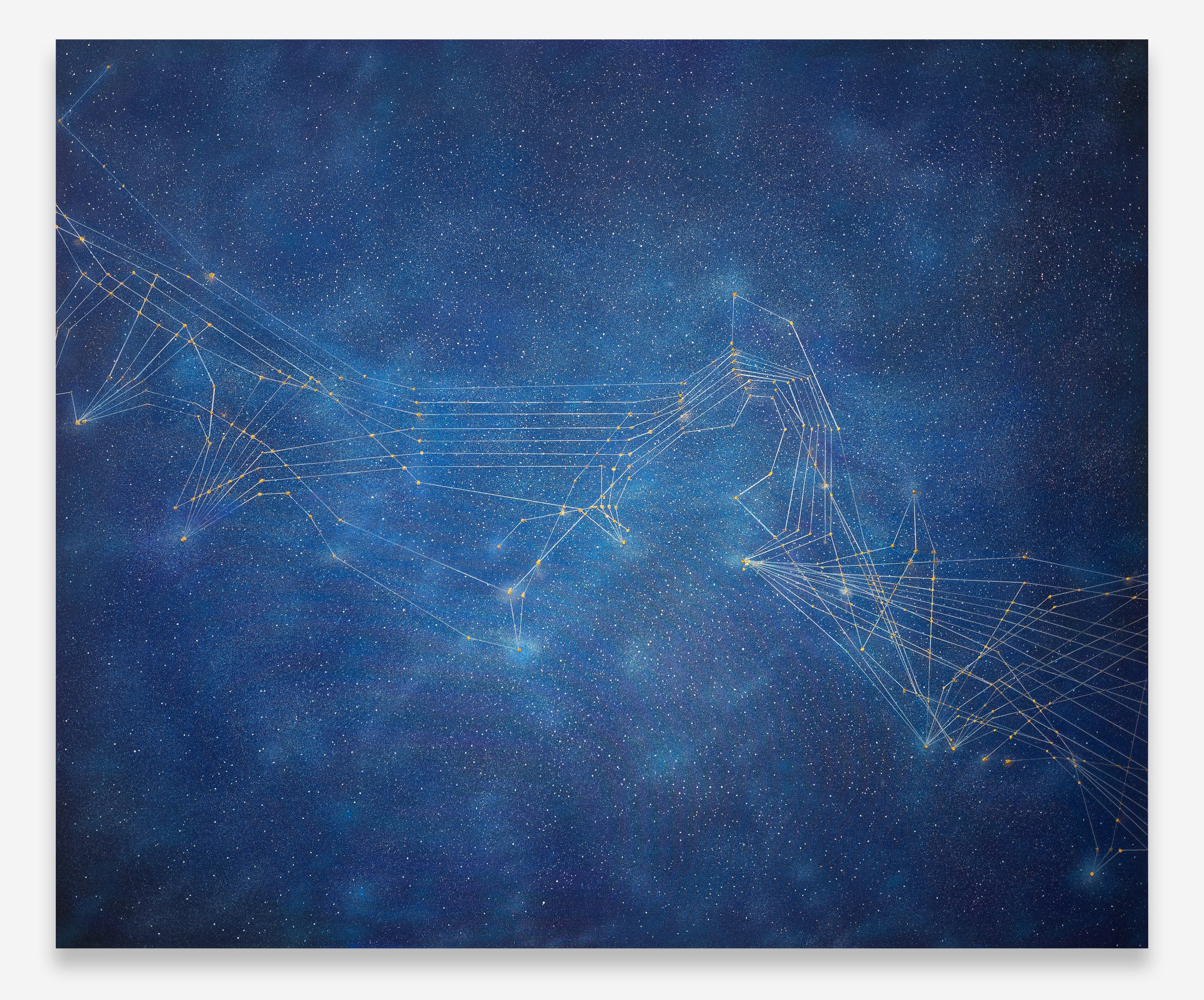
Tan Mu's Signal: Submarine Network 03 (2025) maps the submarine cable infrastructure threading the Persian Gulf, the Arabian Peninsula, and the Horn of Africa. It is the third painting in a series that began with the Northwest Pacific, the region of her hometown, and has since expanded to cover the planet's major cable corridors. Each painting in the Signal series takes a specific maritime zone as its subject and renders its invisible cable routes as luminous constellations against deep oceanic darkness. In this third installment, the geography compresses the stakes of the entire series into a single frame: a body of water so narrow and so heavily wired that the distinction between energy infrastructure and information infrastructure becomes, from the right vantage point, indistinguishable.
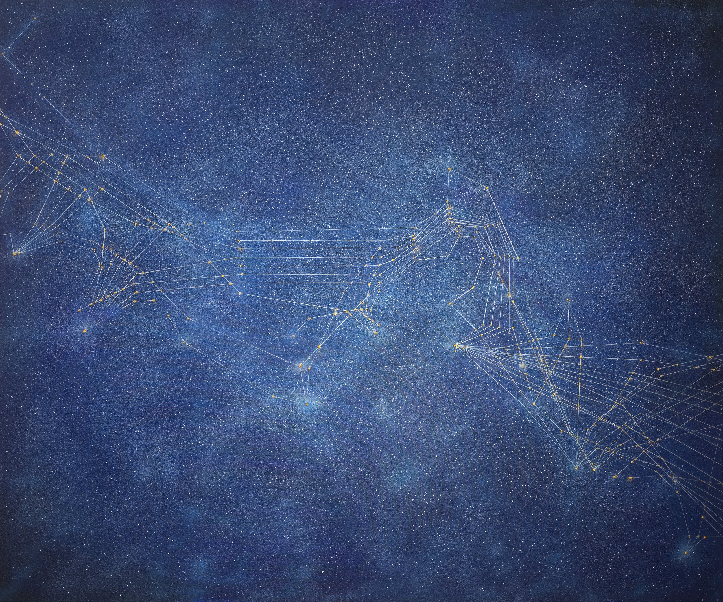
Oil and acrylic on linen, 152.5 x 183 cm (60 x 72 in). The canvas is wider than it is tall, a landscape format that mirrors the horizontal sprawl of the Gulf itself. The linen is primed dark, a near-black ground that reads as deep ocean at night, or as the void of space before stars kindle. Against this ground, Tan Mu deploys her signature vocabulary of small luminous points and thin connecting lines. The points cluster densely along coastlines and thin out across open water, reproducing the actual distribution of submarine cable landing points as documented by TeleGeography's submarine cable map. Qatar's peninsula pushes upward into the field like a thumb, its coastline traced by a concentrated band of bright nodes. The Strait of Hormuz narrows to a pinch on the right edge, where cable lines converge through a gap barely wide enough to contain them. The Horn of Africa hooks downward at the lower left, its sparse landing points registering the asymmetry of connectivity: the same waters that carry some of the world's densest cable traffic also wash coastlines with almost no landings at all.
The paint handling varies deliberately across the surface. At the cable landing points, Tan Mu builds the dots in thick, wax-heavy oil paint, creating raised textures that catch raking light and project physically from the linen. These are not flat marks. They have volume, a sculptural presence that indexes the actual hardware of cable landings: the concrete chambers, the armored pipes, the soldered joints that connect a fiber-optic strand to a terrestrial network. In her conversation with Yiren Shen for 10 Magazine, Tan Mu described these access points as "resembling the soldered connections of electronic circuits," and the tactile quality of the paint enacts this resemblance at the level of material. A finger drawn across the surface would feel the raised nodes where the cables touch land.
The connecting lines, by contrast, are rendered in thin acrylic, sometimes so diluted that the linen weave shows through. They read as traces, ghost paths, rather than as solid marks. This material distinction carries meaning: the landing points are tangible things you could visit and photograph, but the cables between them are buried under kilometers of seawater and sediment. The paint makes the nodes tangible and the routes spectral, which is precisely how these systems exist in reality. The linen itself functions as a kind of cartographic ground, its regular weave suggesting the grid of coordinates that underlies both cable maps and nautical charts.
Color operates with similar precision. The dominant tone is an ultramarine so deep it approaches black, but it is not uniform. Along the Arabian coast, warmer currents of cerulean and indigo rise toward the surface, creating an effect of depth that parallels the bathymetry of the Gulf itself, a shallow sea nowhere deeper than ninety meters. In the regions of open water to the south and west, the blue flattens and darkens, registering the deeper waters of the Arabian Sea and the Gulf of Aden. The cable lines carry a faint phosphorescence, a pale blue-white that reads as data moving through darkness. The painting does not depict the ocean as a viewer would see it from shore or satellite. It depicts the ocean as the cables experience it: a dark medium through which light travels.
Walter De Maria's The Lightning Field (1977) installs four hundred polished stainless steel poles in a rectangular grid across a high desert plain in western New Mexico. The poles are spaced 220 feet apart, extending across a mile of arid ground. Their stated purpose is to attract lightning, though lightning strikes the array only a few times each year. Most of the time, the poles stand in daylight, reflecting sky and ground, producing an experience of space rather than event. The work's power resides in this tension between the systematic and the contingent, between the grid of human intention and the discharge of atmospheric force. De Maria spent years locating the site, testing soil conductivity, calculating spacing to ensure that no pole would be in the shadow of another at any hour. The preparation was exhaustive. The result appears almost minimal.
The structural parallel to Signal: Submarine Network 03 lies in how both works translate invisible forces into spatial coordinates. De Maria's poles map the pathway of electrical discharge through the atmosphere. Tan Mu's nodes and lines map the pathway of optical data through the ocean. Both systems are systematic: every pole has a position, every cable landing has coordinates. Both systems depend on conditions they cannot control: lightning chooses its own path; data routes reconfigure around outages and congestion. And both works locate their content in the gap between the systematic arrangement and the invisible phenomenon it seeks to register. De Maria's poles do not make lightning visible; they make the conditions for lightning legible. Tan Mu's cable map does not make data visible; it makes the architecture of data transmission legible.
The desert and the ocean floor share another quality: both are spaces that human beings almost never occupy directly. De Maria's field is experienced from a distance or from within, but never from above in the way a satellite would see it. The ocean floor is experienced by almost no one. The cables that cross it are laid by specialized ships, maintained by remotely operated vehicles, and repaired by crews who descend to depths where sunlight no longer reaches. In both cases, the artwork creates a proxy for an experience that is otherwise unavailable. The painting and the installation become forms of indirect documentation, translating what is hidden into what can be seen, without ever claiming to show the thing itself.
The Persian Gulf contains one of the highest concentrations of submarine cable landings on the planet. According to TeleGeography's 2025 data, more than a dozen major cable systems converge on the Gulf states, including FLAG, SEA-ME-WE 3 through 6, IMEWE, and the Gulf Bridge International cable. The same waters host the world's densest concentration of oil and gas infrastructure. The co-location is not incidental. The Gulf's economic significance as an energy corridor made it an early and intensive site for telecommunications investment, just as the telecommunications corridors of the North Atlantic were initially laid along the routes of telegraph cables that followed shipping lanes. Infrastructure follows infrastructure. The first transatlantic cable of 1858 prefigured the fiber-optic routes of the twenty-first century not because engineers consciously replicated old paths, but because the economic logic of connecting the same centers of capital and population produces the same corridors, regardless of the technology involved.
Tan Mu's painting registers this layering without diagramming it. The cable routes in Signal: Submarine Network 03 follow the coastlines of Qatar, the United Arab Emirates, Oman, and Iran with a density that visually echoes the tanker lanes and pipeline routes familiar from energy infrastructure maps. A viewer who knows the Gulf's geography will recognize that the thickest clusters of nodes correspond to the locations of the largest oil and gas terminals: Ras Tanura, Fujairah, Das Island. The painting does not label these points. It does not need to. The density of the marks tells the story. Where the cables are thickest, the stakes of connectivity are highest, and the consequences of disconnection would be most severe.
The series' origin in the 2022 Hunga Tonga eruption is relevant here. When the volcanic explosion severed Tonga's single submarine cable, the nation went offline for five weeks. No email, no banking, no contact with diaspora families. The event demonstrated a truth that the Persian Gulf instantiates in concentrated form: connectivity is not distributed evenly, and its absence is not experienced equally. Tonga's isolation was absolute because it had a single cable. The Gulf states have multiple redundant paths, and a single break would be routed around in milliseconds. But the Strait of Hormuz presents a different geometry of risk. A physical obstruction at the strait would not sever a single cable but would threaten the entire bundle of systems passing through the narrowest point. The chokepoint is geographic, not technological, and no amount of network redundancy can route around a closed waterway.
Tan Mu has described the Signal series as mapping "how technology quietly carries human relationships across the planet." In the Persian Gulf painting, this quiet carriage acquires a particular urgency. The data flowing through these cables includes financial transactions that price oil in real time, video calls between migrant workers and their families across South Asia, diplomatic communications between governments whose relationships are mediated by the same energy markets that the cables also serve. The painting's subject is not data in the abstract. It is data in a specific place, under specific pressures, serving populations whose access to the network is shaped by wealth, geography, and the political arrangements that govern the water above the cables.
Alighiero Boetti's Mappa series (1971-1994) consists of over one hundred embroidered world maps in which each country is filled with the design of its national flag at the time of production. The maps were made in Kabul by Afghan weavers who executed Boetti's concept in labor they controlled. The flags changed as regimes fell and borders shifted: the map of 1971 shows a Soviet flag over Afghanistan; by 1992, that flag is gone. The series tracks geopolitical transformation through a single visual system that is neither neutral nor authored by a single hand. Boetti's role was to set the parameters; the weavers determined the execution; history determined the content.
The Mappa's relevance to Signal: Submarine Network 03 is not primarily visual, though both works map territories through abstracted systems of marks. The deeper connection lies in how both artists register the political without polemic. Boetti's maps do not argue about borders. They show borders as they are, at a specific moment, as rendered by specific hands. The political content is embedded in the fact of the flag, not in commentary about it. Similarly, Tan Mu's cable map does not argue about the asymmetry of connectivity. It shows the asymmetry by mapping it. The dense clusters of nodes along the Gulf coast and the near-absence of landings along the Horn of Africa constitute a visual argument about who is connected and who is not, but the argument is made by the data, not by the painter's editorial hand. The painting's authority derives from its fidelity to the TeleGeography coordinates. It is a map of what exists.
There is a further resonance. Boetti's maps were produced in the same geographic zone that Signal: Submarine Network 03 depicts. The weavers worked in Kabul and Peshawar, cities that sit within the frame of Tan Mu's painting, connected to the Gulf by the same submarine cables that her lines trace. The labor that produced the Mappa traveled along precursor routes, the telegraph cables and shipping lanes that preceded fiber optics, linking Italy to Central Asia through the Suez Canal and the Persian Gulf. When Boetti sent designs to Kabul and received finished maps by return post, he was using an earlier version of the infrastructure that now carries data at the speed of light along the ocean floor beneath the same sea. The distance between Boetti's mail and Tan Mu's fiber is measured not in miles but in latency: weeks versus milliseconds. The compression of that interval is one of the subjects the painting registers without stating it.
Li Yizhuo, writing in the BEK Forum catalog essay "Constellations" (2025), observes that submarine cables "fold some areas into pockets of reliable, near-instant communication, of extreme proximity, and stretch the distance between others, as if assigning register, pitch, timbre, and duration to each configuration of individuals, cities, or infrastructural systems on the world map." Her musical metaphor is precise. The Persian Gulf painting makes this folding and stretching spatially legible. The Gulf coast is folded into extreme proximity: the nodes cluster so densely that individual cables become hard to distinguish, the way tones in a dense chord become hard to separate. The Horn of Africa is stretched into distance: its few nodes sit in relative isolation, separated by long lines that traverse open water before reaching the next landing. The painting assigns different densities of connection to different coastlines, and these densities correspond to different economic and political realities. The contrast is not added by the artist. It is given by the infrastructure itself.
Yiren Shen's interview with Tan Mu for 10 Magazine opens with a scene from Werner Herzog's Lo and Behold (2016), in which internet pioneer Ted Nelson recalls skimming his fingers across a lake as a child, watching ripples form, break apart, and rejoin. Nelson describes this as "a fleeting vision of the universe as an ever-shifting web." The image is apt for the Signal series as a whole, but it carries particular weight for the Persian Gulf painting, where the web is not abstract but geographically anchored. The ripples in Nelson's lake are concentric and evenly distributed. The cables in Signal: Submarine Network 03 are anything but. They concentrate where capital concentrates and thin where capital withdraws. The web is ever-shifting, but it shifts along lines that were drawn by earlier webs, and those by earlier ones still, back through the telegraph and the trade route to the caravan and the footpath. The Persian Gulf has been a corridor of exchange for five thousand years. The fiber-optic cables are the most recent layer. They will not be the last.
Tan Mu has said that the Signal series began with the Northwest Pacific because "it includes my hometown. Beginning there allowed the project to grow outward from something personal rather than abstract." Each subsequent painting expands the map, adding a new geographic and emotional layer. The Persian Gulf painting adds a layer that is simultaneously about data and about what data runs alongside. The cables share the seafloor with oil pipelines not by coincidence but by economic logic: the regions that generate the wealth that funds cable construction are the regions that need the cables to manage that wealth. The painting maps a single compressed zone where two kinds of flow, one of energy and one of information, become difficult to separate. The nodes that mark cable landings also mark the proximity of oil terminals. The lines that trace data routes also trace the geometry of a chokepoint that controls both systems. When the Strait of Hormuz narrows at the right edge of the canvas and the cable lines converge through a gap barely wide enough to contain them, the painting shows not just how data travels but what data travels through: a strait that could, on any given day, make the entire network reconfigure around an absence.
The submarine cable map of the Persian Gulf is, in the end, a map of dependencies. Data depends on cable. Cable depends on the seafloor. The seafloor depends on the political arrangements that govern the water above it. Remove any layer and the whole structure reconfigures. Tan Mu's painting makes this layering visible by mapping the infrastructure itself, without the overlay of coastline or national boundary that would frame it in familiar geographic terms. What remains is a constellation of points and lines suspended in deep blue, a star chart for a world that runs on light it cannot see. The cables carry everything and are themselves carried by a strait twenty-one nautical miles wide. Everything passes through. Nothing is guaranteed.